Between 1578 and 1584, Spain commissioned its officials in Mexico to create sets of local maps that would include descriptions of local resoures, history and geography. At 6 pm on Tuesday, Oct. 18, Barbara Mundy will talk about that effort in “Mapping the New World for the Spanish Kings: The 16th-Century Project of the Relaciones Geográficas." The event is free in the museum auditorium.
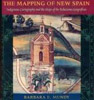
Mundy wrote The Mapping of New Spain: Indigenous Cartography and the Maps of the Relaciones Geograficas, which was awarded the Nebenzahl Prize in the History of Cartography in 1996. The book offered an artistic interpretation of the maps but placed them in a larger historical context – one that illuminated both the Amerindian (Aztec, Mixtec, and Zapotec) and Spanish traditions while tracing how colonization reshaped their respective world views.
Mundy is a professor in the Department of Art History and Music at Fordham University, where she specializes in Latin American art of the colonial period.
Last year, the History Museum’s Fray Angélico Chávez History Library featured books, prints and maps from its John Bourne Collection of Meso-Americana, the Rare Books Collection, and the Map Collection, for the exhibition Imagining Mexico: From the Aztec Empire to Colonial New Spain. An electronic version of the exhibit is at this link. Often created for people who would never cross the Atlantic but live their adventures vicariously, the works formed perceptions – fictitious at times – of the land of Cortés, Moctezuma, amazing temples and important battles.
Download high-resolution images from Imagining Mexico by clicking on "Go to related images" at the bottom of this page.


