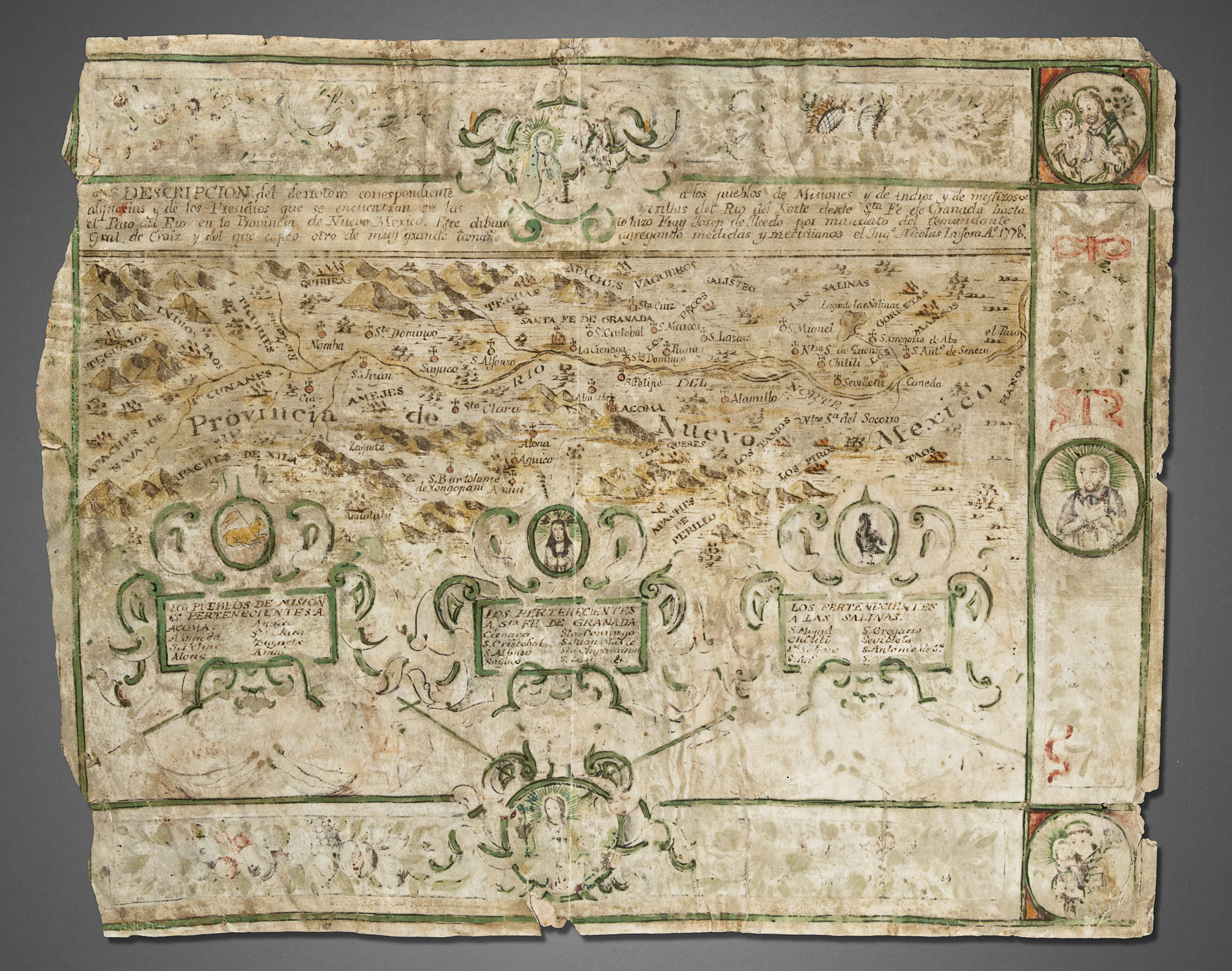
Provincia de Nuevo Mexico
From the press release:
Between the Lines: Culture and Cartography on the Road to Statehood
Nicolás La Fora, Provincia de Nuevo Mexico. Hand-drawn, on vellum, 1778. Courtesy Rodrigo Rivero Lake, Art and Antiques, International
La Fora was a captain in the Bourbon-reforms-created Spanish Royal Corps of Engineers. He joined the expedition of inspection (1766-1767) of northern New Spain led by the Marquéz de Rubí that traveled approximately 7,600 miles. La Fora scientifically mapped various parts of northern New Spain. The Royal Engineers mapped only what they could observe and measure. They discounted hearsay information, even from resident Native peoples. This horizontal map of the Rio Grande is not one of the official maps of the expedition and probably was created at the later date as a more artistic presentation piece when he was the corregidor (district magistrate) of Oaxaca.
Note: Representative image at left is often cropped for display purposes. Downloaded high-resolution images are not cropped.

